Most dangerous highway roads in the world
 |
| Yungas road (Bolivia) |
The North Yungas Road (also known as Grove's Road,
Coroico Road, Death Road or Road of fate. IT is a road leading from La
Paz to Coroico, 56 kilometers (35 mi) northeast of La Paz in the Yungas
region of Bolivia. In 1995 the Inter-American Development Bank christened it as
the "world's most dangerous road". In 2006, one estimate stated that
200 to 300 travelers were killed yearly along the road. The road includes cross
markings on many of the spots where vehicles have fallen.
he South Yungas
Road La Paz La Paz North Road.
 |
| Dalton highway (Alaska) |
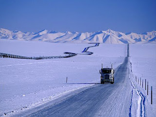
2.Dalton Highway (Alaska)
The James W. Dalton Highway, usually referred to as
the Dalton Highway Alaska Route
 |
| Guoliang tunnel (China) |
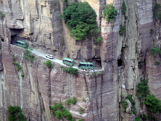
3.Guoliang Tunnel (China)
The Guoliang Tunnel is carved along the side of and
through a mountain in China. The tunnel links the village of Guoliang to the
outside through the Taihang Mountains which are situated in Huixian, Xinxiang, Henan
Province of China.
 |
| Stelvio pass (Italy) |
4.Stelvio pass (Italy)
The Stelvio
Pass (Italian: Passo dello Stelvio ) is a mountain pass in northern Italy, at an elevation of 2,757 m (9,045 ft) above sea level. It is the highest
paved mountain pass in the Eastern Alps, and the second highest in the Alps,
just 45 m (148 ft) below France's Col
de la Bonette (2,802 m (9,193 ft)).
 |
| Karakoram highway (Pakistal) |
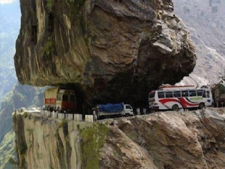
5.Karakoram highway (Pakistan)
The Karakoram Highway (KKH) is one of the highest paved
international roads in the world. It connects the Xinjiang Uyghur Autonomous Region of China and Gilgit–Baltistan of Pakistan across the Karakoram mountain range, through the Khunjerab Pass, located at 36°51′00″N 75°25′40″E, at an elevation of 4,693 meters
(15,397 ft).
Connecting China's Xinjiang region with Gilgit–Baltistan region of Pakistan, the road is a
popular tourist attraction. Due
to its high elevation and the difficult conditions in which it was constructed,
it is referred to as the Eighth
Wonder of the World. The Karakoram Highway is known informally as the KKH; within Pakistan it is
known officially as the N-35,
while within China, it is known officially as China National Highway 314 (G314). It is also a part of
the Asian Highway.
 |
| Skipper canyon ( New Zealand) |
6.Skipper Canyon ( New Zealand)
Skippers Canyon is a
historic and scenic gorge, some 22 kilometers in length, that is located
several kilometers north of Queenstown. Today
accessed from Queenstown via the same road that leads to Coronet Peak ski field,
Skippers Canyon houses the Shot
over River, one of New Zealand's richest
gold-bearing rivers which was named by William
Gilbert Rees. Rees, his wife Frances and
brother-in-law Nicholas von Tunzelmann were the first European settlers in and
near where Queenstown is now located. Once a busy gold mining area, Skippers
Canyon was accessed by Skippers Road, which is today one of New Zealand's
better known scenic roads. The main New Zealand road where rental car insurance
is not honored if driven on, Skippers Road is mostly one-way, narrow and steep
with sheer drops of several hundred meters. Apart from its gold mining history,
Skippers Canyon was also the site where electricity was first generated at a
place called Bullendale, a small former gold
mining settlement some 4 hours walk from the farthest end of Skippers Road.
 |
| Sichuan-Tibbet highway ( Chiana) |
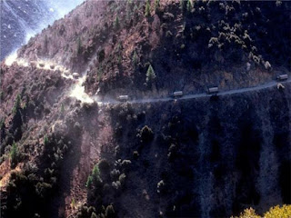
7.Sichuan-Tibbet highway (Chiana)
The Sichuan-Tibet
Highway is a high-elevation road that begins in Chengdu of Sichuan on the east
and ends at Lhasa in Tibet on the west. The road is 2,142km long
The Sichuan-Tibet Highway, originally
called the Kangding-Tibet Highway (a section of the No. 318 National Trunk
Highway) takes you through vast, open landscapes with majestic peaks vaulting
skyward. The plateau areas are dotted with castellated Tibetan homes and an
infinite number of contentedly munching yaks. Travelers can enjoy the
magnificent and changeable scenery ranging from warm spring to cold and snowing
winter, which makes you intoxicated. This climate will be changing in front of
you and you may think “days in heaven, but years on the earth”. The trip may
take around 15 days if you you are not in a hurry. The Sichuan-Tibet
Highway is also infamously known for bad driving surfaces and sharp
mountain-side hairpins. Driving along single track sections in bad weather can
be a great challenge to a less experienced driver.
 |
| Trollstigen ( Norway) |
8.Trollstigen (Norway)
Trollstigen (English: Trolls' Path) is a serpentine mountain road in Rauma Municipality, county, Norway.
It is part of Norwegian County Road 63 that connects the town of Åndalsnes in Rauma and the village of Valldal in Norddal
Municipality. It is a popular tourist attraction due to its steep incline of
10% and eleven hairpin bends up a steep mountainside. During the
top tourist season, about 2,500 vehicles pass daily. During the 2012 season,
161,421 vehicles traversed the route, compared to 155,230 vehicles during 2009.
The road is narrow with many
sharp bends, and although several bends were widened during 2005 to 2012,[5] vehicles over 12.4 meters (41 ft) long
are prohibited from driving the road. During the 2011 and 2012 seasons, buses
up to 13.1 meters (43 ft) were temporarily allowed as a trial. At the 700-metre (2,300 ft)
plateau there is a car park and several viewing balconies
overlooking the bends and the Stigfossen waterfall. Stigfossen falls 320 meters
(1,050 ft) down the mountainside. The pass has an elevation of
approximately 850 meters (2,790 ft).
 |
| BR-116 (Brazil) |
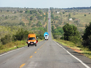
9.BR-116 (Brazil)
BR-116 is a
federal highway of Brazil. One of
the most important highways in Brazil and one of its longest, the 4,385 kilometers
(2,725 mi) road connects Fortaleza to Jaguarão.
BR-116 is a merciless
2,700-mile stretch of federal highway of Brazil spearing up the coast of the
country. At 4,385 kilometres (2,725 mi), it’s the second longest highway of the
country, running from the north of Brazil to the south, roughly parallel to the
coastline. It’s the worst road in the world for the sexual exploitation of children.
The surface of the road is
asphalted. It links Fortaleza in Ceará State with Jaguarão near the Uruguay
border, in the state of Rio Grande do Sul. It’s one of the main important
highways in the country. It has the highest concentration of truckers. The BR-116
is the most active road in the world for the sexual exploitation of children.
262places along the BR-116 where children are known to be sold for sex – the
equivalent of one every ten miles. The problem is ignored, and victims are
found hundreds of miles outside of their home towns. Brazil itself is second
only to Thailand in the number of children in prostitution – half a million are
estimated to live in this way (UNICEF).
 |
| Commonwealth Avenue ( Philippines) |
10.Commonwealth Avenue (Philippines)
Commonwealth Avenue (Filipino: Abenida Komonwelt), formerly
known as Don Mariano Marcos
Avenue (Tagalog: Abenida Don Mariano Marcos),
named after the father of President Ferdinand
Marcos, is a 12.4 km (7.7 mi) highway located in Quezon City, Philippines, which spans
from 6 to 18 lanes and is the widest in the Philippines. It is one of the major
roads in Metro Manila and is designated as part of Radial Road 7 (R-7).
Commonwealth Avenue starts from
the Quezon Memorial Circle inside the Elliptical Road, and it passes through
the areas of Philcoa, Tandang Sora, Balara, Batasan Hills and ends at Quirino
Highway in the Novaliches area.
https://en.wikipedia.org

Nice article thanks for sharing with us.
ReplyDeleteexamtapasya
ctet
resultview
hssc clerk result 2016
Rajasthan Gram Sevak Syllabus 2016
tnx for ur comments
ReplyDeleteSSC MTS Application Form 2019 will be released in December 2018. Earlier, the application form was scheduled to be released on November 3, 2018 and the last date to apply was December 3. However, the application process has been delayed till further notice.
ReplyDeleteRailway Recruitment Board completed the Group D 2018-19 Examination procedure and those who were in search of their live available RRB Group D Result 2019 performance they should need to wait for few days because RRB all set to complete the checking process of Railway Group CEN 02/2018 Online Test.
ReplyDelete